|
|
Compressor Station Noise Study, Bradford County, Pennsylvania |
Noise Analysis,
Proposed PacifiCorp Lake Side Power Plant, Vineyard, Utah - Project Manager,
2004 and 2007.
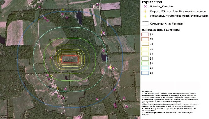
The purpose of the noise study is to evaluate whether the noise levels
generated by the proposed Summit Vineyard Lakeside Power Plant (Lakeside Power
Plant) comply with relevant noise limits established in the surrounding
communities, and conform to the surrounding land use and zoning. To evaluate the potential noise impacts that
the proposed plant would produce we assessed the land use of areas surrounding
the proposed power plant location and compiled relevant noise limits
established by state and/or local ordinances for the various land uses
surrounding the proposed plant. Using
GIS, the modeling of future maximum noise levels associated with the proposed
power plant operation was performed using analytical calculations. The results
of our modeling indicated the predicted noise levels generated by the proposed
power plant would be in compliance with surrounding land uses. Follow up
analysis following the commencement of plant operations in 2007 indicated that
plant operations noise at full generation capacity did not exceed the 2004
modeled noise estimates. |
Eagle Island Restoration Project, Boise River
Ada County, Idaho, Senior Geologist 2010 – Present. Following a review and integration of
one-foot aerial imagery, two–meter LiDAR, and existing geologic map layers at greater
detail the surficial engineering geology mapping of the Eagle Island area was
prepared at best scales using GIS analysis. Additionally historical 1939 aerial
photography layers were integrated into the GIS database to demonstrate landscape
change for the area. This data will be
used by the Geotechnical Engineer, and USA Corps of Engineers Environmental
Scientist for restoration decision-making. |
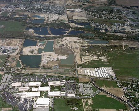 Eagle Island area, Ada County. Idaho Eagle Island area, Ada County. Idaho
|
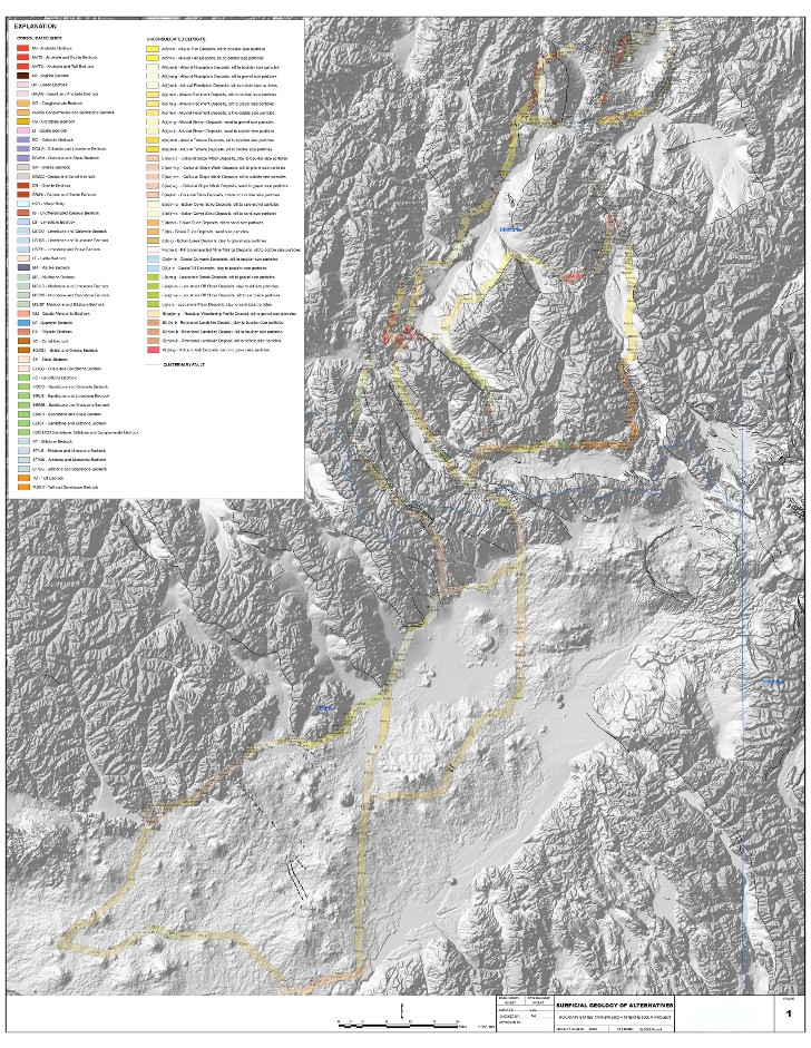 Montain States Transmission Intertie Project, Montana and Idaho Montain States Transmission Intertie Project, Montana and Idaho
Earth Resource Assessment,
Mountain States Transmission Intertie Project - From 2007 to 2008. The
Mountain States Transmission Intertie (MSTI) project is planned for the
construction of a 500kv transmission line from west-central Montana to
south-central Idaho to provide power grid relief in this part of the country. Although straight-line distance between the
connecting substations are approximately 280 miles, nearly 990 miles of routing
comprising 31 segment alternatives were evaluated to fulfill environmental
planning requirements. Engineering geology
issues evaluated in this characterization included surficial geology, mass
movement potential, slope conditions, active faults, seismic zonation and
liquefaction potential. To individually
characterize these issues, each segment was mapped at “best-scales” using a GIS
to integrate vector, raster and digital elevation information across the two
state area. The GIS enabled the numeric
quantification of the geological issues thereby allowing the environmental
planners to compare and assess geologic and environmental impacts along the
route segments. |
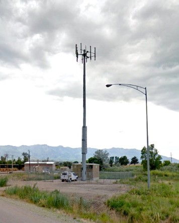
Morgan County Fairgrounds cell tower site, Morgan, Utah
|
Cell Tower Siting and Permitting, Throughout Utah and Surrounding States, Project- Client- Manager
1992-Present. Prepared documents and permits for the siting on
numerous new-tower, co-locate, and temporary cell-on-wheels throughout Utah, Wyoming, Idaho and Nevada. Projects typically consists of 1) Geotechnical soils and foundation study, 2) Phase I environmental screening and 3) NEPA environmental screening checklist. |
Ely Airport Mineral Survey for
Airport Development Group, White Pine County, Nevada - Project Manager, 2006. Mineral survey conducted at the supervision of
the Bureau of Land Management. Mineral survey facilitated the conveyance transfer of 1,544 acres of the public lands located adjacent
to Yelland Field, or Ely Airport to White Pine County. The transfer
allowed for the expansion and development of airport facilities, and encourage
development of air service and aviation-related industry. Survey was conducted to assess mineral potential
of transfer lands. The conveyance was provided for by the White Pine County
Conservation, Recreation, and Development Act of 2006. |
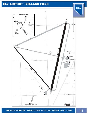
Pilots guide, Ely Airport, White Pine County, Nevada |
 South State Street Noise Assessment, Sandy, Utah South State Street Noise Assessment, Sandy, Utah
|
South
State Street CATX-Noise Analysis - Project Manager, 2004. Noise
Analysis for State Street from 9000 South Street to 10600 South Street in Salt
Lake County, Utah. Project requires taking existing noise measurements with
2B-3080 noise monitor, a detailed analysis using noise prediction model TNM
2.5, and determining the feasibility of noise mitigation using Federal Highway
Administration guidelines. Noise assessment and mitigation modeling using the
TNM 2.5,and ArcView GIS also performed to identify the appropriate mitigation
options. The results of the studies and the impacts of each alternative are to
be considered and documented for inclusion in the CATX Document. |
Dugway Proving
Ground, Michael Army Airfield Fixed Wing Runway Environmental Assessment -
Project Manager, 2004. The environmental assessment for reconstruction and
operational activities at the Michael Army Airfield, Dugway (MAAF) Proving Grounds was
performed to evaluate potential environmental impacts of these activities. The
EA describes and evaluates potential impacts to the following resources from
the proposed construction and operation of the Airfield reconstruction project.
The issues assessed include (1) vegetation, (2) wildlife, (3) threatened or
endangered species, (4) water quality, (5) air quality, (6) soil impacts, (7)
cultural resources, (8) land use, (9) hazardous and toxic materials, (10)
socio-economic resources and (11) noise. The EA describes existing conditions
of these resources, evaluates potential impacts to these resources and identifies
mitigation activities for these impacts.
A range of alternative actions including the no action alternative was
evaluated. Our team conducted a detailed site assessment of the potentially
impacted areas of the installation and providing full documentation of
compliance with the NEPA process and other applicable Federal and State
environmental laws and regulations including but not limited to: The Clean Air
Act, Clean Water Act, Endangered Species Act and the National Historic
Preservation Act and Army Regulation AR-200-2.
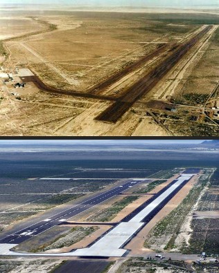
Original and completed MAAF runway facilities pictured here
|
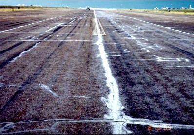
The MAAF runway was deteriorated and in need of replacement, Dugway Proving Ground, Utah
|

Protected borrowing owls inhabit parts of the Dugway Proving Ground |
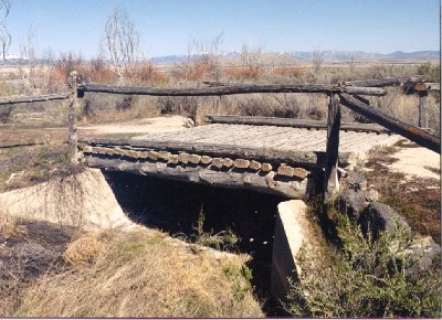
Historic Lincoln Highway bridge preserved near the Proving Ground runway |
Proposed
Park Well, Wilkinson Cottonwood Mutual Water Company Environmental Assessment, Mountain
Green, Utah (Federal Revolving Fund Project #3F036) - Project Manager, 2005. Because
federal funds were involved with this well development, an environmental
assessment (EA) was required. The
requirements of this EA were regulated and reviewed by the Utah State Division
of Drinking Water, Department of Environmental Quality. This EA primarily involved desk-top studies
and correspondences with “cross-cutter” agencies to inform of the proponent’s
proposed actions. Two public meetings
were announced and held in Mountain Green at the commencement and conclusion EA
studies.
NEPA Environmental
Assessment, Granite Flowline; Big Cottonwood Canyon, Utah - Project Manager,
1996. Supervised in-house and contract team
consisting of geologist, hydrogeologist, geotechnical engineers, traffic
engineers, landscape architects, soil scientists, environmental specialists,
and plant and animal biologists. The
NEPA assessment was conducted for PacifiCorp under review specifications by the
Wasatch National Forest. The assessment
of proposed and alternative actions assisted National Forest personnel in
selecting a preferred alignment for the two-mile hydroelectric pipeline
alignment. |
|
|