|
|
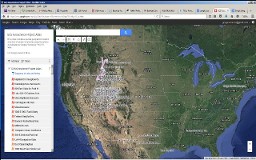 |
New GCS Geoscience Project Atlas KML |
This Atlas includes a partial geographic location inventory of geoenvironmental project locations investigated by Gregory Schlenker, PhD, PG, principal investigator of GCS Geoscience LLC. |
|
|
GCS Geoscience Locations, USA |
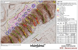 |
Draper Debris Flow Hazard Evaluation
|
Debris-flow hazard
evaluation involves the analysis of ten independent basins impacting a site in
Draper, Utah. Analysis involved
evaluating and estimating a predicted debris-flows volumes using an 1)
empirical Precipitation-Event Volume Analysis and 2) physical Sediment-Bulking
Volume Analysis. The two analysis allow
for designers to develop realistic hazard reduction measures for site development
improvements. |
|
|
|
|
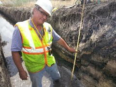 |
One Airport Phase -
II Fault Hazard Evaluation |
A 30-acre site near
the Salt Lake City International Airport was investigated for exposure to
surface fault rupture hazards related to the active West Valley fault
zone. Trenching on the site revealed
fault displacements of pre-historic Great Salt Lake sediments on the eastern
margin of the site. Fault setback
recommendations using State of Utah guidelines calculated and recommended for
site development planning and layout for the proposed commercial/industrial use
of the site. |
|
|
|
|
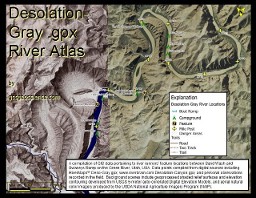 |
Desolation-Gray .gpx River Atlas
|
A compilation of GIS data pertaining to river runners’ feature locations between Sand Wash and Swaseys Ramp on the Green River, Utah, USA. Data points compiled from digital sources including RiverMaps™ Deso-Gray.gpx; www.riverbrain.com Desolation-Canyon.gpx; and personal observations recorded in the field. Background scenes include geoprocessed shaded relief surfaces and elevation contouring developed from USGS 5-meter auto-correlated Digital Elevation Models, and aerial natural color imagery produced by the USDA National Agriculture Imagery Program (NAIP). |
|
|
Desolation-Gray Canyon, Utah
|
 |
Geologic and
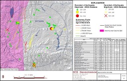
Geoseismic Studies, Austin-Wall Dam Level II Study |
Evaluated engineering
geology and geological hazards for the Austin-Wall Dam. Seismic hazard characterization was also
conducted to utilizing state of the art Next Generation Attenuation Relationships
(NGA) criteria to estimate the Maximum Credible Earthquake (MCE) and the
Operating Basis Earthquake (OBE) seismic response for the dam site. |
|
|
|
|
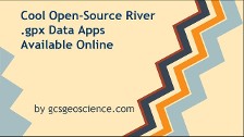 |
Cool Open-Source River .gpx Data Apps Avaiable Online |
Tutorial guide prepared to demonstrate river runners online .gpx (GPS) data availability, and practice use applications. |
|
|
|
|
|
|