|
|
Surface Fault/Earthquake Hazards
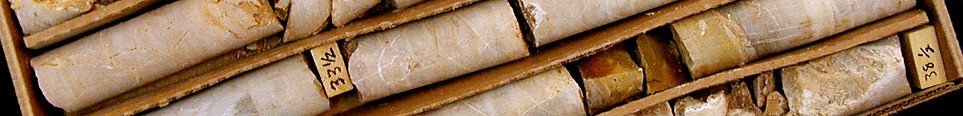
Exposed trace Wasatch Fault Zone, Payson, Utah |
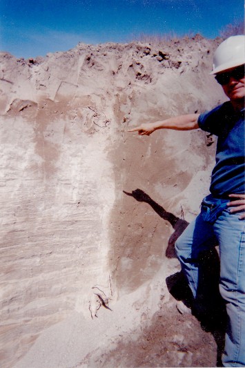
One Airport Phase II Fault Rupture Hazard Evaluation, Salt
Lake City, Utah - Senior Geologist, 2014. A 30-acre site near
the Salt Lake City International Airport was investigated for exposure to
surface fault rupture hazards related to the active West Valley fault
zone. Trenching on the site revealed
fault displacements of pre-historic Great Salt Lake sediments on the eastern
margin of the site. Fault setback
recommendations using State of Utah guidelines calculated and recommended for
site development planning and layout for the proposed commercial/industrial use
of the site.
Exposed trace West Valley Fault Zone, One Airport Phase II project, Salt Lake City, Utah
|
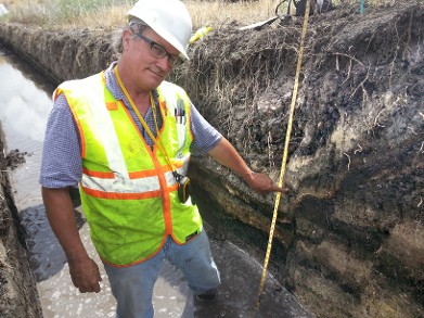
Surface Fault
Rupture Hazard Evaluation, SR 201 Interchange Structures; Salt Lake City, Utah
- Project Geologist, 2002. This
investigation was conducted to evaluate the presence or absence of surface
fault rupture hazards that could potentially affect highway interchange
structures included for consideration in an environmental evaluation. The study
included the excavation and logging of five exploration trenches at two
proposed interchange locations to evaluate potential surface fault rupture
hazards impacting the construction. Trenches were excavated to depths that
exposed Pleistocene-age sediments, and were observed to determine the presence
or absence of fault-related deformation in the Pleistocene-age sediments. The findings
of the investigation which were corroborated with
previous work by others concluded no indications of active fault deformation were
observed in the trenches or believed to impact proposed structures.
|
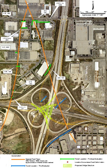
SR-201 & I-215 Interchange showing mapped West Valley Fault Zone traces, proposed structures and fault evaluation trench locations, Salt Lake City, Utah |
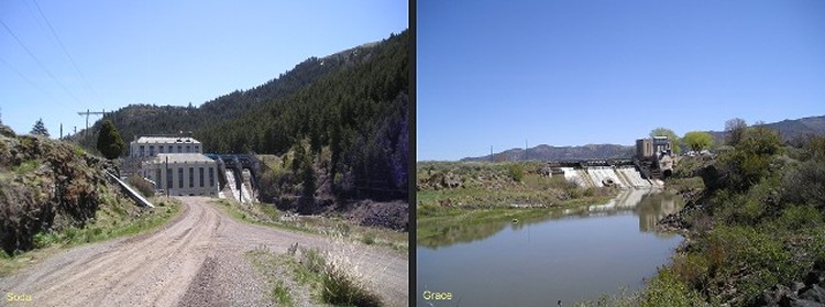
Soda and Grace dams, Caribou County, Idaho
|
Geoseismic
Evaluation PacifiCorp Soda and Grace Dams; Caribou County, Idaho - Project
Manager, 2006. The Grace Dam
consists of a 51-foot-high by 180-foot-long rock-filled timber crib dam, with
250 acre-feet of usable storage capacity, and Soda Dam consists of: a
103-foot-high by 433-foot-long concrete gravity dam, with an active storage
capacity of 16,300 acre-feet. Because
these dams were undergoing studies for Federal Energy Regulatory Commission
(FERC) re-licensing, the FERC requested that a seismic studies be conducted
which addresses the capability of regional earthquake faults to the dam structures.
The conducted required studies characterized the seismic exposure of the
two dam sites consistent with the Federal Guidelines for Dam Safety, which
include probabilistic earthquake parameters as well as calculating the Maximum
Credible Earthquake (MCE) and the Operating Basis Earthquake (OBE) for the site
from the site. |
|
|